Existing vs As-Built Surveys – What’s the Difference?
128 City Rd, EC1V 2NX
+44 20 4615 4666
hello@linesurveying.uk
Laurel Hardwicke
February 20, 2026
If you are planning a refurbishment, extension or redevelopment project, you may need a measured building survey. However, many property owners are unsure what actually happens during the process.
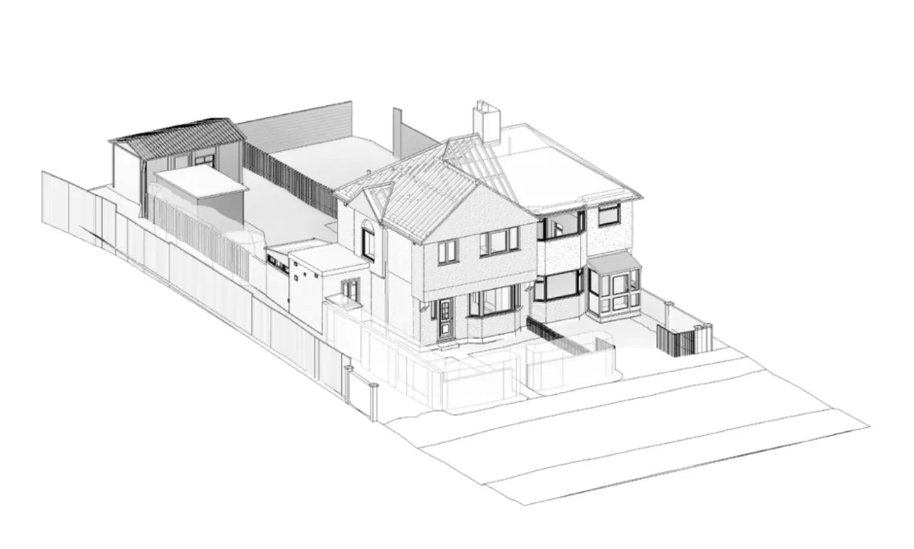
A measured building survey provides accurate drawings and dimensional information of an existing property. These drawings form the foundation for architectural design, planning applications and construction works.
At Line Surveying UK, we deliver professional measured building surveys across London and the UK, supplying reliable data to architects, engineers and construction professionals.
Every measured building survey begins with a discussion about project requirements.
During this stage, the survey team confirms the type of drawings needed. These may include:
Floor plans
Elevations
Sections
Roof plans
Level information
The scope depends on the building and the purpose of the survey. For example, a simple planning application may require less detail than a full refurbishment or redevelopment scheme.
Agreeing the scope early ensures the survey captures everything required.
The next step is the site visit.
Traditionally, measurements were taken manually. Today, modern equipment allows for far greater accuracy and efficiency. Surveyors commonly use:
3D laser scanning
Total stations
Digital measuring devices
Laser scanning captures millions of data points, recording the geometry of the building in detail. As a result, walls, floors and structural elements are documented accurately.
During the visit, surveyors also record visible services, structural features and any notable building details.
Accurate level information is essential in a measured building survey.
Surveyors typically record:
Finished floor levels
Ceiling heights
Staircase dimensions
Window and door sizes
Structural elements
Because this information is gathered systematically, the likelihood of errors is significantly reduced.
For complex or older buildings, additional care is taken to capture irregular shapes and non-standard layouts.
After the site visit, the collected data is processed in the office.
If laser scanning has been used, the point cloud data is registered and checked for accuracy. Using software such as AutoCAD and Revit, technicians then produce scaled drawings that reflect the true condition of the building.
At this stage, floor plans, elevations and sections are created based on precise measurements.
Quality checks are carried out before the drawings are issued to the client.
The completed survey is delivered in digital formats suitable for design teams.
Outputs may include:
2D CAD drawings
3D models
Point cloud files
PDF copies for review
Because the drawings are based on accurate site data, architects and engineers can proceed with confidence.
The duration depends on the size and complexity of the building.
Smaller residential properties can often be surveyed in a single day. Larger commercial buildings may require multiple days on site and additional processing time.
Although the process may take time, accurate data collection prevents delays later in the project.
Inaccurate base drawings often lead to redesign work, coordination problems and construction delays.
By contrast, a professional measured building survey ensures that design teams work from reliable information. As a result, planning applications are stronger and construction risks are reduced.
Investing in accuracy at the beginning saves both time and money throughout the project.
Line Surveying UK provides accurate measured building surveys across London and the UK.
Our team uses modern technology and structured survey methods to deliver reliable drawings that integrate seamlessly into AutoCAD and Revit workflows.
From concept through to construction, we support architects and engineers with dependable survey data.
Yes. Even small projects benefit from accurate baseline drawings.
Yes. 3D laser scanning improves accuracy and captures detailed geometry efficiently.
When carried out professionally, measured building surveys achieve high positional accuracy suitable for architectural and engineering design.
If you are planning alterations or redevelopment works, commissioning a measured building survey is an essential first step.
Contact Line Surveying UK today to discuss your project and request a tailored quotation.
We use cookies to improve your experience on our site. By using our site, you consent to cookies.
Manage your cookie preferences below:
Essential cookies enable basic functions and are necessary for the proper function of the website.
These cookies are needed for adding comments on this website.
Statistics cookies collect information anonymously. This information helps us understand how visitors use our website.
Google Analytics is a powerful tool that tracks and analyzes website traffic for informed marketing decisions.
Service URL: policies.google.com (opens in a new window)
You can find more information in our Cookie Policy and .