Existing vs As-Built Surveys – What’s the Difference?
Existing vs As-Built Surveys – What’s the Difference? Laurel Hardwicke February 20, 2026 For Architects Existing vs As-Built Surveys...

128 City Road, London
+44 20 4615 4666
hello@linesurveying.uk
Answers to common questions about how our surveys are carried out, what to expect on site and how the process works.
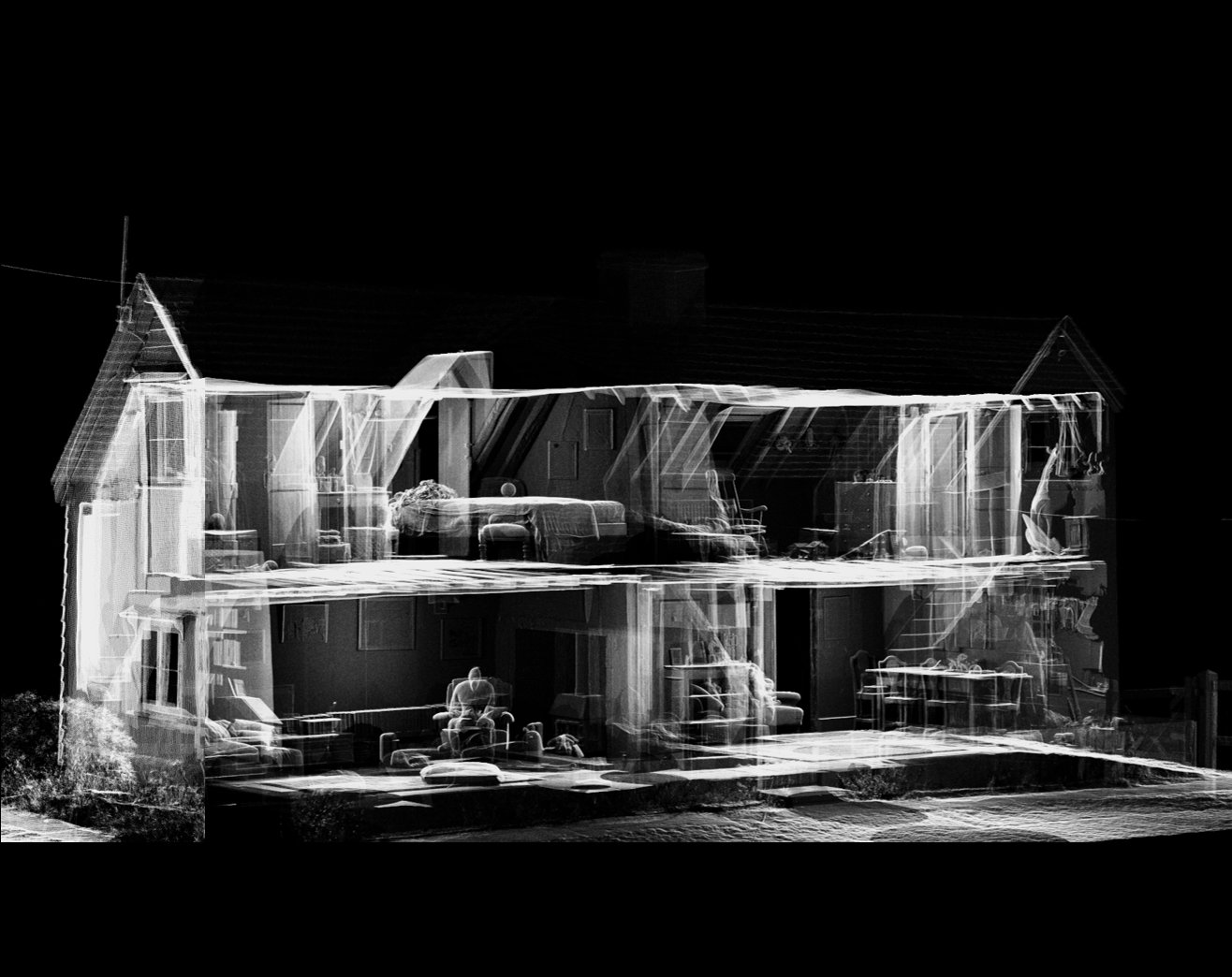
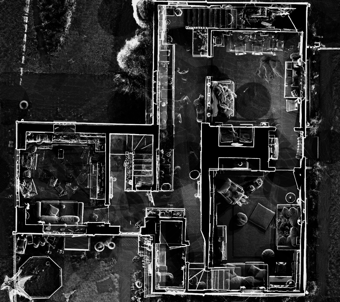
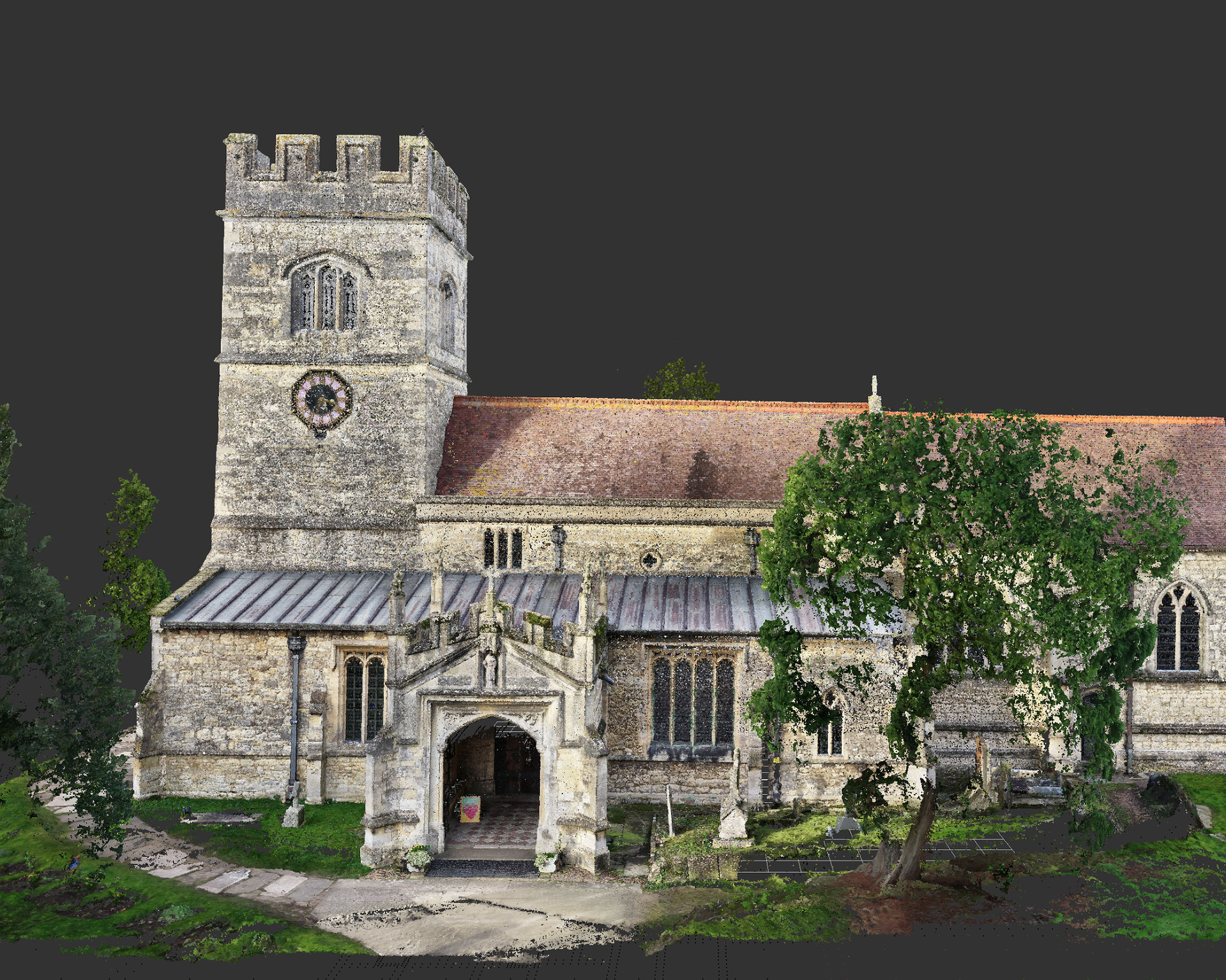
We use advanced 3D laser scanning and digital survey equipment to capture accurate internal and external data. This allows us to produce detailed floor plans, elevations and sections suitable for planning and design.
Survey work is non-invasive. Our equipment captures data without damaging surfaces or structures. Minor access to rooms and external areas is required, but disruption is kept to a minimum.
At Line Surveying, Survey duration depends on the size and complexity of the property. Most residential measured surveys are completed within one day. Larger or complex sites may require additional time.
Turnaround times vary depending on project scale, but drawings are typically issued within an agreed timeframe following site capture.
We recommend that rooms are accessible and reasonably clear to allow accurate measurement. Restricted access areas may affect detail level in final drawings.
Yes. Surveys can be completed while properties are occupied, provided access is available.
We provide highly accurate measured building surveys, topographical surveys and drone photogrammetry services across London.
Technical information for architects, designers and consultants.
Our 3D laser scanning equipment provides millimetre-level accuracy (typically ±2–3mm under standard conditions). Final outputs are suitable for architectural and construction workflows.
We provide drawings in DWG and PDF formats as standard. Point cloud data and additional formats can be supplied upon request.
Point cloud data suitable for BIM modelling workflows can be supplied. If specific modelling standards are required, these should be confirmed at quotation stage.
Topographical surveys can be supplied in local grid or tied into OS grid coordinates upon request.
Visible surface features are included. Underground services require separate detection surveys unless otherwise agreed.
Survey outputs are issued for the commissioning client and project only. Third-party reliance should be agreed in writing.
Clear, accurate survey data delivered on time and to specification.
We share practical guidance on measured building surveys, topographical surveys, drone photogrammetry and planning considerations for London property projects.
Whether you are an architect, developer or homeowner, our articles help you make informed decisions before work begins.
Existing vs As-Built Surveys – What’s the Difference? Laurel Hardwicke February 20, 2026 For Architects Existing vs As-Built Surveys...
Measured Surveys for Planning Applications – What’s Required? Max Hardwicke February 20, 2026 For Architects Measured Surveys for Planning...
Drone Photogrammetry for Large Residential Sites Laurel Hardwicke February 20, 2026 For Architects Drone Photogrammetry for Large Residential SitesLarge...
We use cookies to improve your experience on our site. By using our site, you consent to cookies.
Manage your cookie preferences below:
Essential cookies enable basic functions and are necessary for the proper function of the website.
These cookies are needed for adding comments on this website.
Statistics cookies collect information anonymously. This information helps us understand how visitors use our website.
Google Analytics is a powerful tool that tracks and analyzes website traffic for informed marketing decisions.
Service URL: policies.google.com (opens in a new window)
You can find more information in our Cookie Policy and .