Existing vs As-Built Surveys – What’s the Difference?
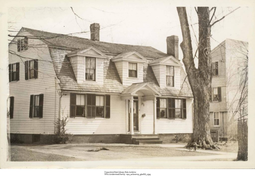
Existing vs As-Built Surveys – What’s the Difference? Laurel Hardwicke February 20, 2026 For Architects Existing vs As-Built Surveys – What’s the Difference? If you’re planning alterations, refurbishments or extensions, you may come across two similar terms: existing building surveys and as-built surveys. Although they are often mentioned together, they serve very different purposes. Understanding […]
Measured Surveys for Planning Applications – What’s Required?
Measured Surveys for Planning Applications – What’s Required? Max Hardwicke February 20, 2026 For Architects Measured Surveys for Planning Applications – What’s Required? If you’re preparing a planning application, an accurate measured survey forms the foundation of your entire project. Without precise drawings of the existing building, planning authorities cannot properly assess the proposed changes. […]
Drone Photogrammetry for Large Residential Sites
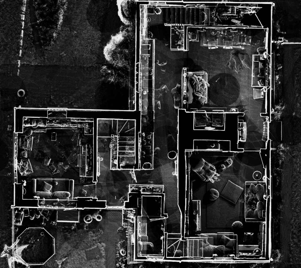
Drone Photogrammetry for Large Residential Sites Max Hardwicke February 20, 2026 For Architects Drone Photogrammetry for Large Residential Sites Large residential developments require accurate and efficient surveying solutions. On multi plot schemes, traditional ground surveys often slow progress and interrupt workflow. Because of these limitations, many developers now adopt drone photogrammetry to increase speed and […]
Why Survey Accuracy Matters in Heritage Projects
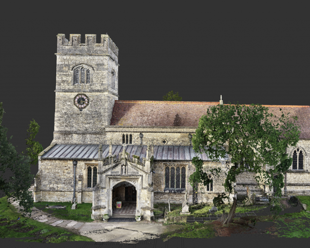
Why Survey Accuracy Matters in Heritage Projects Max Hardwicke February 20, 2026 For Architects Why Survey Accuracy Matters in Heritage Projects Heritage buildings require special attention, precision and understanding. Unlike modern structures, historic properties often contain irregular geometry, structural movement and delicate materials. As a result, survey accuracy becomes critical to the success of any […]
How to Use Point Cloud Data in AutoCAD & Revit
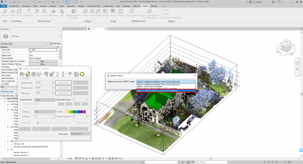
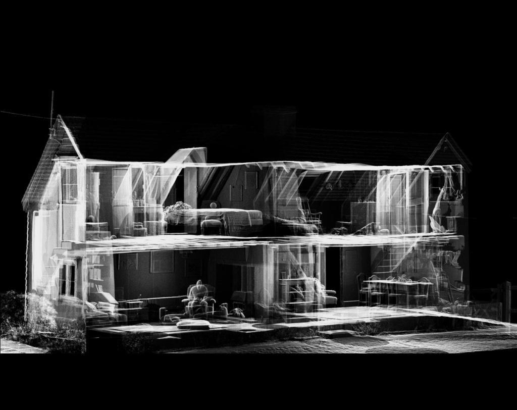
How to Use Point Cloud Data in AutoCAD & Revit Max Hardwicke February 20, 2026 For Architects How to Use Point Cloud Data in AutoCAD and Revit Point cloud data has become an essential part of modern surveying and design workflows. By capturing millions of precise data points with a 3D laser scanner, surveyors […]
When Should You Commission a Topographical Survey?

When Should You Commission a Topographical Survey? Max Hardwicke February 20, 2026 For Architects When Should You Commission a Topographical Survey A topographical survey provides accurate information about the natural and man made features of a site. It records levels, boundaries, buildings, drainage covers and other important elements that influence design and construction decisions. However, […]
Common Errors in Architectural Drawings Caused by Poor Survey Data

Common Errors in Architectural Drawings Caused by Poor Survey Data Max Hardwicke February 20, 2026 For Architects Common Errors in Architectural Drawings Caused by Poor Survey Data Architectural drawings form the foundation of any construction project. However, when those drawings are based on inaccurate or incomplete survey data, serious problems can follow. Even small […]
How Point Cloud Data Improves Design Accuracy
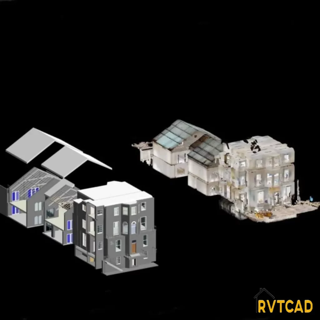
How Point Cloud Data Improves Design Accuracy Max Hardwicke February 20, 2026 For Architects How Point Cloud Data Improves Design Accuracy Accurate design begins with dependable information. In construction and refurbishment projects, even minor measurement errors can cause redesign work, programme delays and increased costs. For this reason, point cloud data has become a critical […]
Laser Scanning vs Traditional Tape Measurement
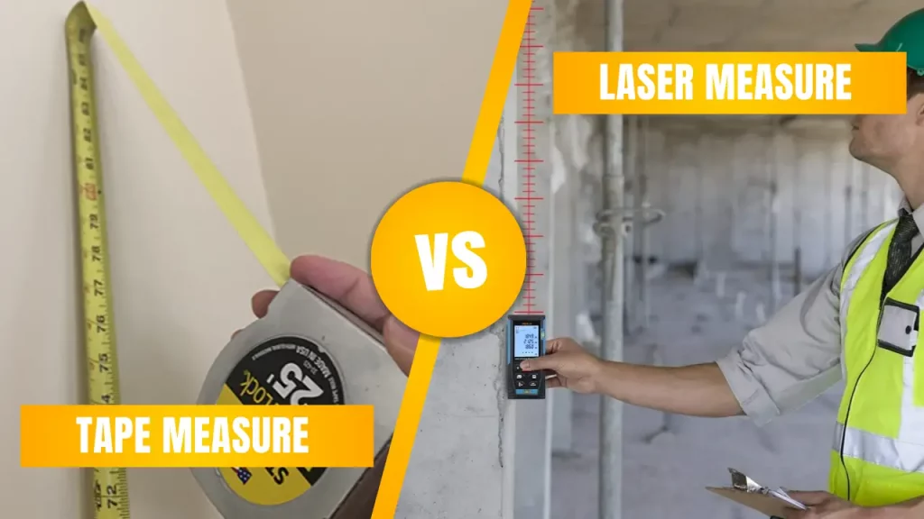
Laser Scanning vs Traditional Tape Measurement Max Hardwicke February 20, 2026 For Architects Laser Scanning vs Traditional Tape Measurement Accurate measurement is essential to the success of any construction project. However, the method used to collect that data can significantly affect design quality, coordination and overall reliability. When comparing laser scanning vs traditional tape measurement, […]
Why Accurate Existing Condition Surveys Save Time in Design

Why Accurate Existing Condition Surveys Save Time in Design Max Hardwicke February 20, 2026 For Architects Existing Condition Surveys | Save Time in Design Existing condition surveys are essential for saving time in the design process. Accurate design depends on reliable information, and when drawings are based on incorrect or incomplete data, delays quickly follow. […]