Existing vs As-Built Surveys – What’s the Difference?

128 City Road, London
+44 20 4615 4666
hello@linesurveying.uk
Max Hardwicke
February 20, 2026
Drone roof surveys have become increasingly popular for assessing residential and commercial properties. However, many property owners and managers still ask the same question: how accurate are drone roof surveys compared to traditional access methods?
Accuracy is essential when evaluating roof condition or calculating repair areas. The good news is that, when carried out professionally, drone roof surveys provide highly reliable results.
At Line Surveying UK, we deliver accurate drone roof surveys across London and the UK without the need for scaffolding or cherry pickers.
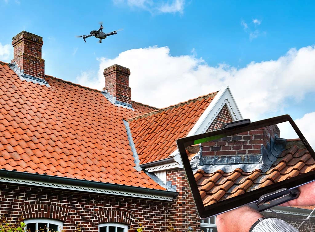
A drone roof survey uses an unmanned aerial vehicle equipped with high resolution cameras to capture detailed images of a roof structure. The drone records photographs from multiple angles, allowing surveyors to assess condition safely from ground level.
In addition, the captured imagery can be processed into a 3D model if required. As a result, inspections become safer, faster and more efficient than traditional methods.
For visual inspections, drone roof surveys offer a high level of accuracy. Modern drone cameras capture detailed imagery capable of showing cracked tiles, damaged flashing and blocked gutters.
Furthermore, built in stabilisation systems ensure clear images even at height. Consequently, surveyors can zoom into specific areas without losing detail.
When measurements are required, accuracy depends on the processing method used. For general condition reporting, high resolution imagery is more than sufficient. However, when area calculations are needed, photogrammetry software can generate scaled 3D models for reliable measurement.
Traditionally, roof inspections required scaffolding, ladders or cherry pickers. While these methods allow close physical access, they are often expensive and disruptive.
In contrast, drone surveys offer several advantages:
Improved safety without working at height
Faster setup and deployment
Minimal disruption to occupants
High resolution visual reporting
The ability to repeat inspections over time
Although physical access may still be necessary for structural testing, drone surveys provide an accurate and efficient first stage assessment.
When assessing roof condition, drones perform exceptionally well. Clear aerial imagery allows surveyors to identify:
Broken or slipped tiles
Flashing damage
Blocked gutters
Cracking and weathering
Vegetation growth
Because the entire roof is documented visually, reports are comprehensive and easy to understand.
Drone roof surveys can also support measurement tasks through photogrammetry.
By capturing overlapping images, the software generates a scaled 3D model of the roof. From this model, professionals can calculate:
Roof area
Pitch angle
Ridge height
Material quantities
While laser scanning may provide higher precision for complex structures, drone photogrammetry delivers reliable measurement accuracy for most residential and commercial roofs.
Several factors influence the accuracy of a drone roof survey.
Weather conditions, such as strong winds, can affect stability. Operator experience also plays a crucial role in capturing usable data. In addition, equipment quality directly impacts image clarity and measurement precision.
For this reason, choosing an experienced and insured drone survey provider is essential.
Drone roof surveys are particularly suitable for:
Residential properties
Commercial buildings
Schools and public buildings
Pre purchase inspections
Insurance assessments
In these cases, drones provide clear visual reporting without the cost and disruption of traditional access methods.
Line Surveying UK provides professional drone roof surveys using high resolution equipment and structured capture methods.
Our surveys support maintenance planning, condition reporting and repair assessments across London and the UK. By combining technical expertise with safe operating procedures, we ensure both accuracy and efficiency.
Yes. Drone surveys reduce the need to work at height, significantly improving safety.
Yes. When processed using photogrammetry software, drones can produce scaled models suitable for area calculations.
Not always. In some situations, follow up physical inspections may still be required for structural testing.
If you are looking for a safe and accurate way to inspect your roof, a professional drone roof survey may be the ideal solution.
Contact Line Surveying UK to discuss your requirements and receive a tailored quotation.
We use cookies to improve your experience on our site. By using our site, you consent to cookies.
Manage your cookie preferences below:
Essential cookies enable basic functions and are necessary for the proper function of the website.
These cookies are needed for adding comments on this website.
Statistics cookies collect information anonymously. This information helps us understand how visitors use our website.
Google Analytics is a powerful tool that tracks and analyzes website traffic for informed marketing decisions.
Service URL: policies.google.com (opens in a new window)
You can find more information in our Cookie Policy and .