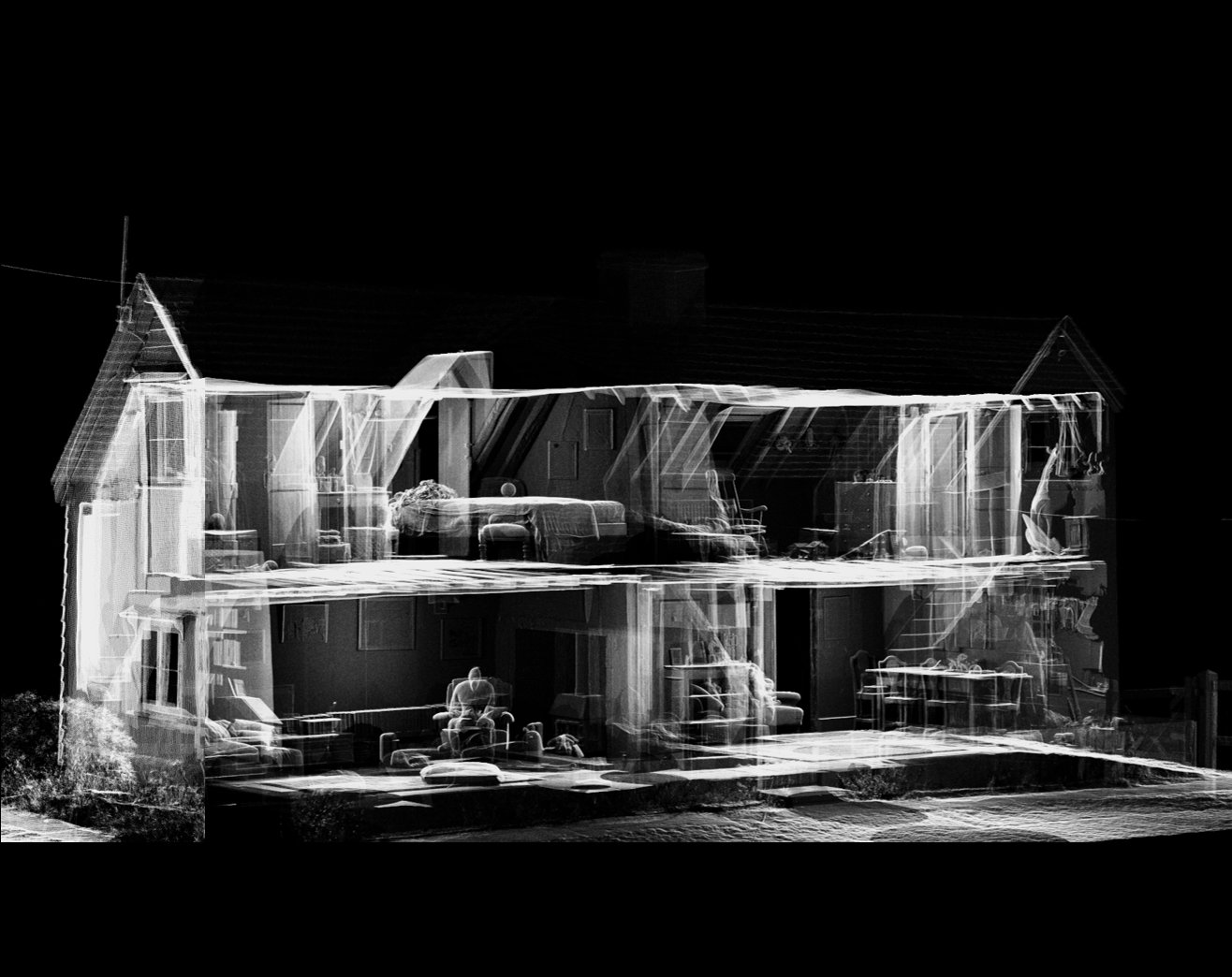
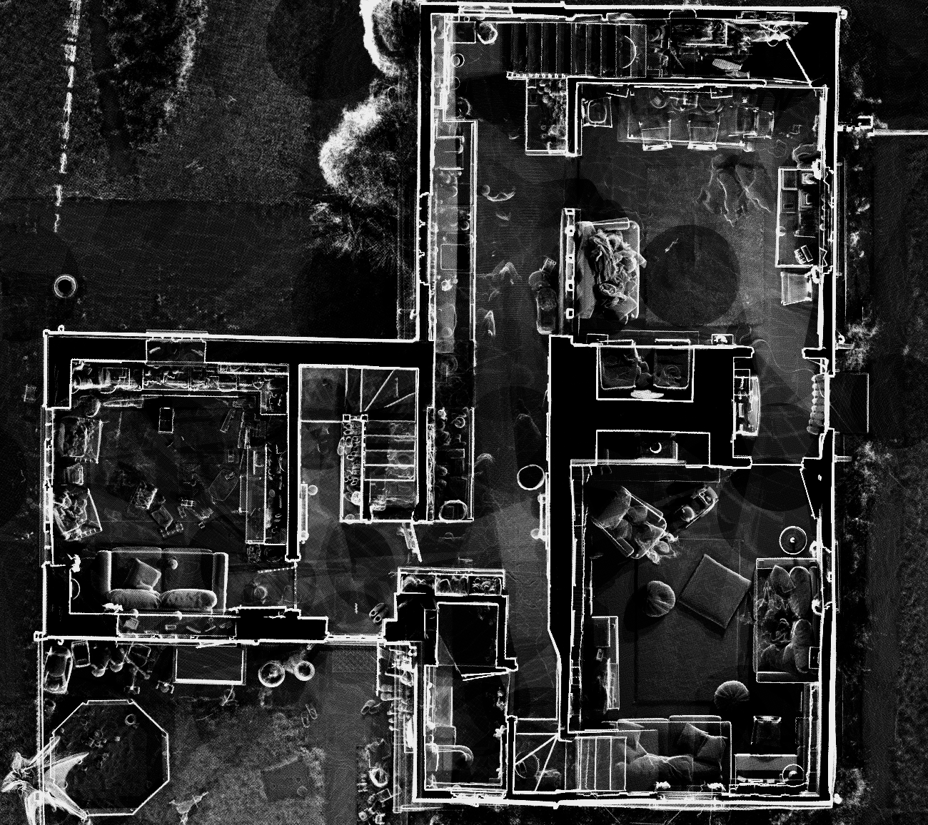
Existing vs As-Built Surveys – What’s the Difference?
Existing vs As-Built Surveys – What’s the Difference? Laurel Hardwicke February 20, 2026 For Architects Existing vs As-Built Surveys...

128 City Road, London
+44 20 4615 4666
hello@linesurveying.uk

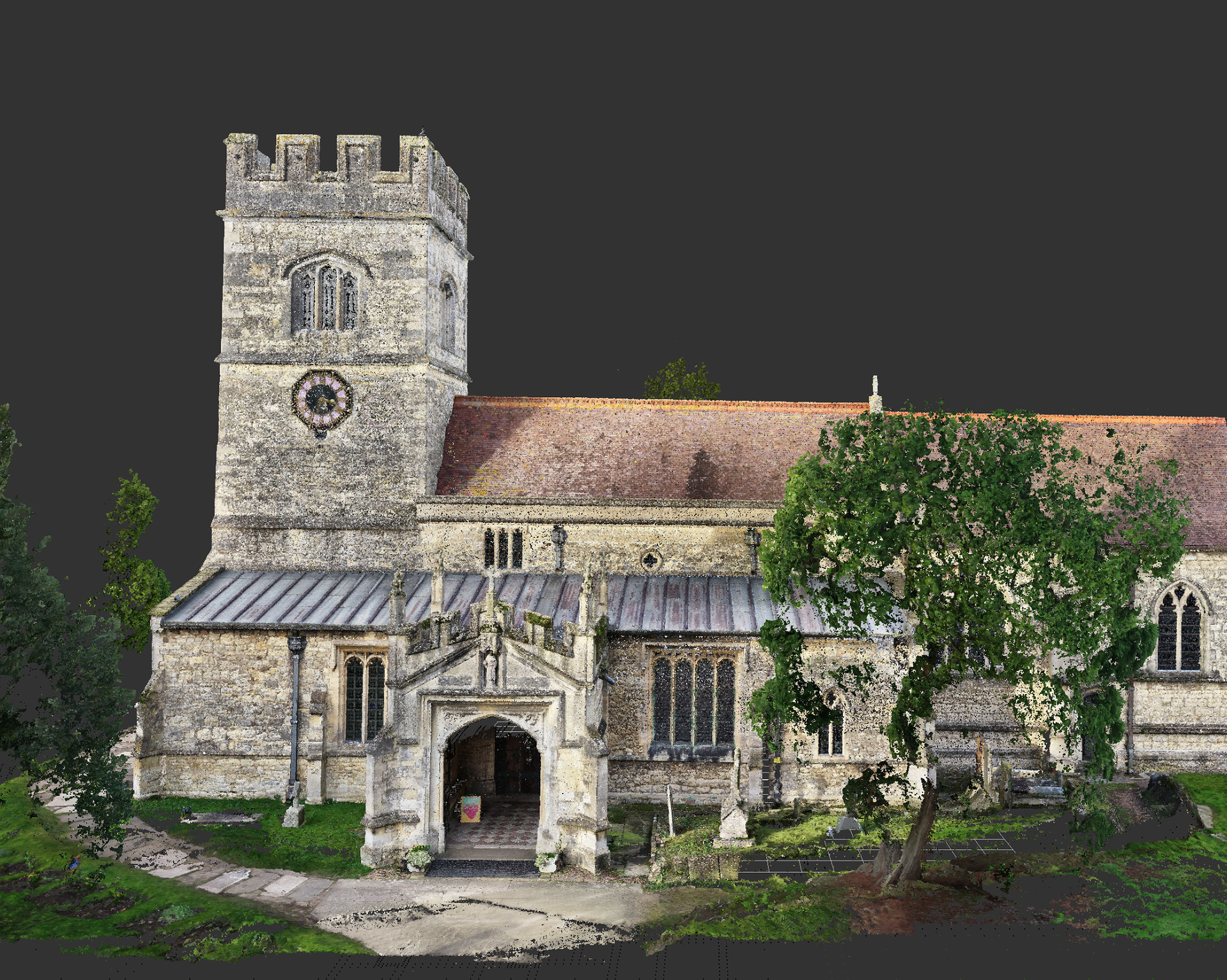
At Line Surveying, we provide high-accuracy drone photogrammetry surveys across London for residential, commercial and development projects.
Using advanced UAV technology and specialist processing software, we generate detailed 3D models, orthomosaic maps and survey-grade data suitable for planning, design and construction.
Our drone surveys provide fast, safe and cost-effective large-area data capture without disruption.
Our experienced UAV survey team combines CAA-compliant flight operations with professional survey control to deliver dependable photogrammetry outputs.
We use ground control points (GCPs) and RTK-enabled drones to ensure survey-grade accuracy suitable for:
Generate detailed orthomosaic imagery and georeferenced survey data.
Ideal for development sites, estates, land parcels and infrastructure projects.
Create Digital Surface Models (DSM) and Digital Terrain Models (DTM).
No scaffolding, access towers or heavy equipment required.
Reduces site time and large ground-based survey requirements.
1. Initial Consultation
We review site location, size, objectives and required outputs.
2. Flight Planning & Risk Assessment
CAA-compliant flight planning including airspace checks and safety procedures.
3. On-Site Data Capture
High-resolution aerial image capture using RTK-enabled UAVs.
4. Data Processing & 3D Reconstruction
Images processed into accurate orthomosaics, 3D models and point clouds.
5. Final Deliverables
You receive survey-grade outputs ready for planning, design or analysis.
Answers to common questions about how our surveys are carried out, what to expect on site and how the process works.
Drone photogrammetry uses overlapping aerial imagery to generate accurate 3D models, orthomosaic maps and survey data.
With RTK and ground control points, surveys can achieve centimetre-level accuracy depending on site conditions.
Orthomosaic maps, 3D models, point clouds, contour plans, DSM/DTM data and CAD-ready outputs.
Yes — drone surveys are ideal for site progress tracking, stockpile measurement and land development projects.
Most small to medium sites can be flown within a few hours, with processed outputs typically delivered within a few working days.
We provide professional drone photogrammetry surveys throughout Greater London and surrounding areas for developers, architects & contractors.
Articles covering measured building surveys, topographical surveys, drone photogrammetry and planning guidance for London property projects.
Existing vs As-Built Surveys – What’s the Difference? Laurel Hardwicke February 20, 2026 For Architects Existing vs As-Built Surveys...
Measured Surveys for Planning Applications – What’s Required? Max Hardwicke February 20, 2026 For Architects Measured Surveys for Planning...
Drone Photogrammetry for Large Residential Sites Laurel Hardwicke February 20, 2026 For Architects Drone Photogrammetry for Large Residential SitesLarge...
We use cookies to improve your experience on our site. By using our site, you consent to cookies.
Manage your cookie preferences below:
Essential cookies enable basic functions and are necessary for the proper function of the website.
These cookies are needed for adding comments on this website.
Statistics cookies collect information anonymously. This information helps us understand how visitors use our website.
Google Analytics is a powerful tool that tracks and analyzes website traffic for informed marketing decisions.
Service URL: policies.google.com (opens in a new window)
You can find more information in our Cookie Policy and .