Existing vs As-Built Surveys – What’s the Difference?
Existing vs As-Built Surveys – What’s the Difference? Laurel Hardwicke February 20, 2026 For Architects Existing vs As-Built Surveys...

128 City Road, London
+44 20 4615 4666
hello@linesurveying.uk
At Line Surveying, we deliver high-accuracy topographical site surveys across London for residential, commercial and development projects.
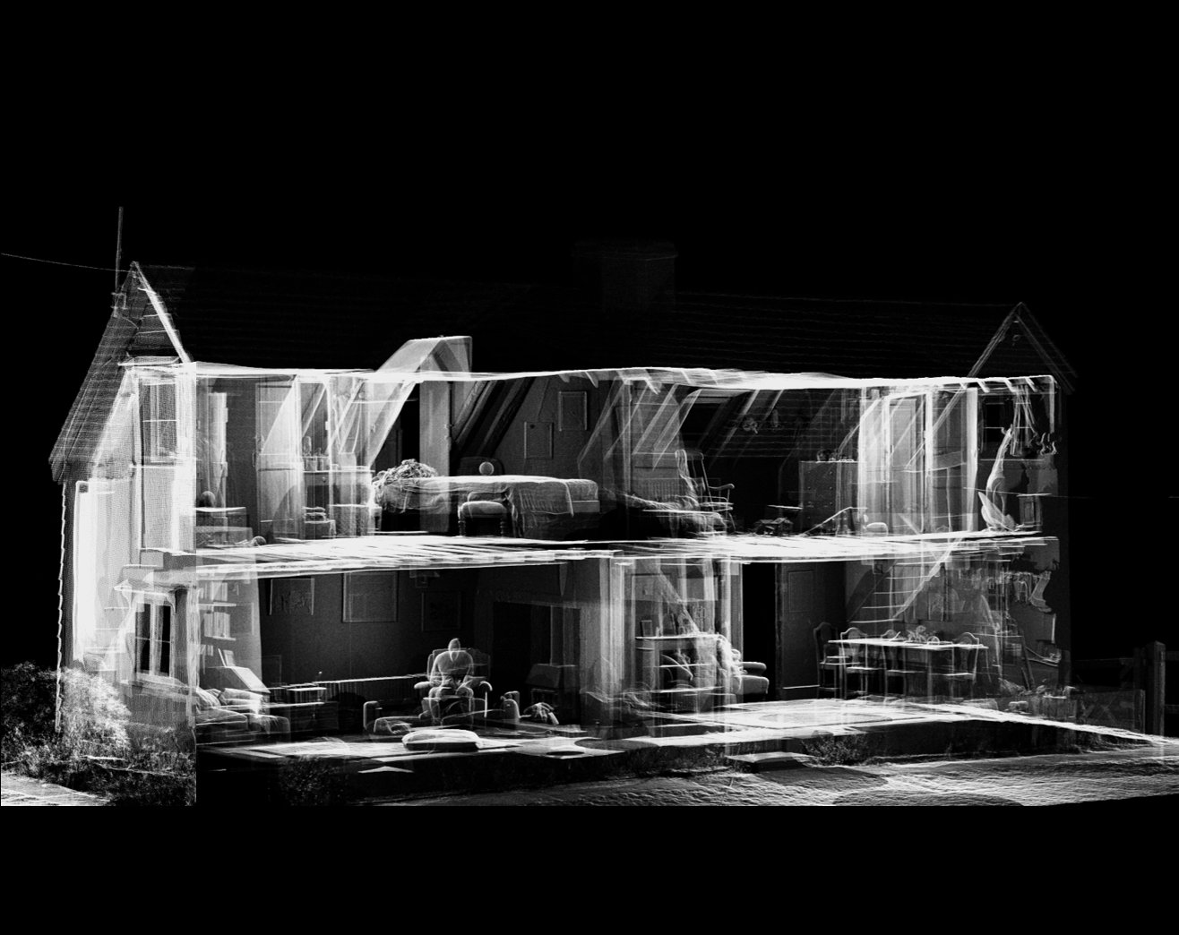
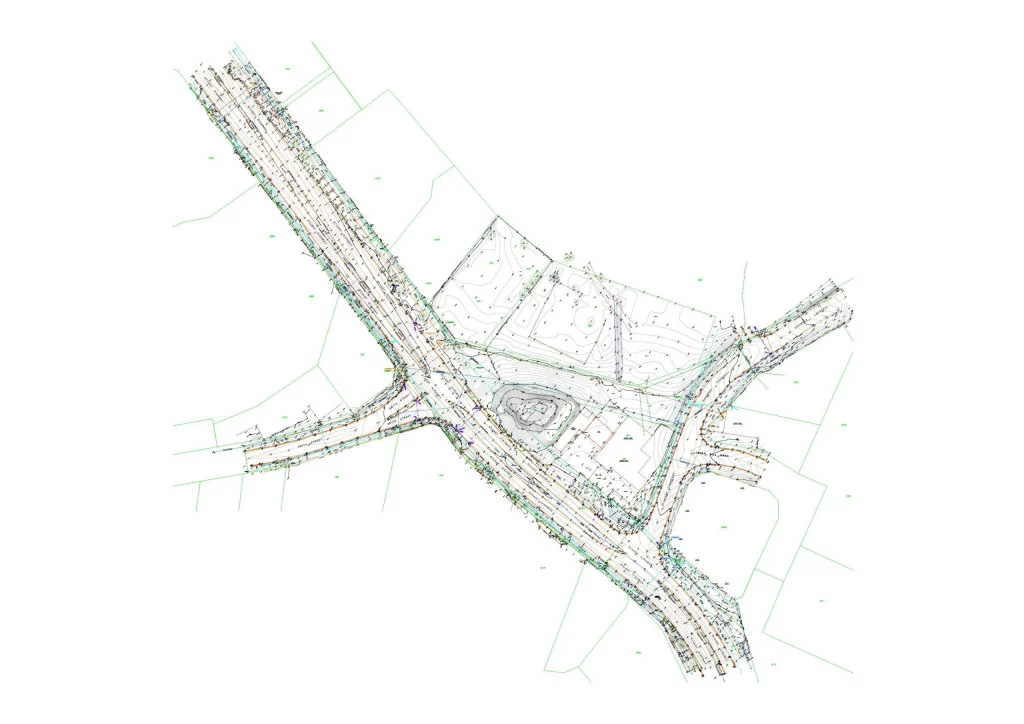
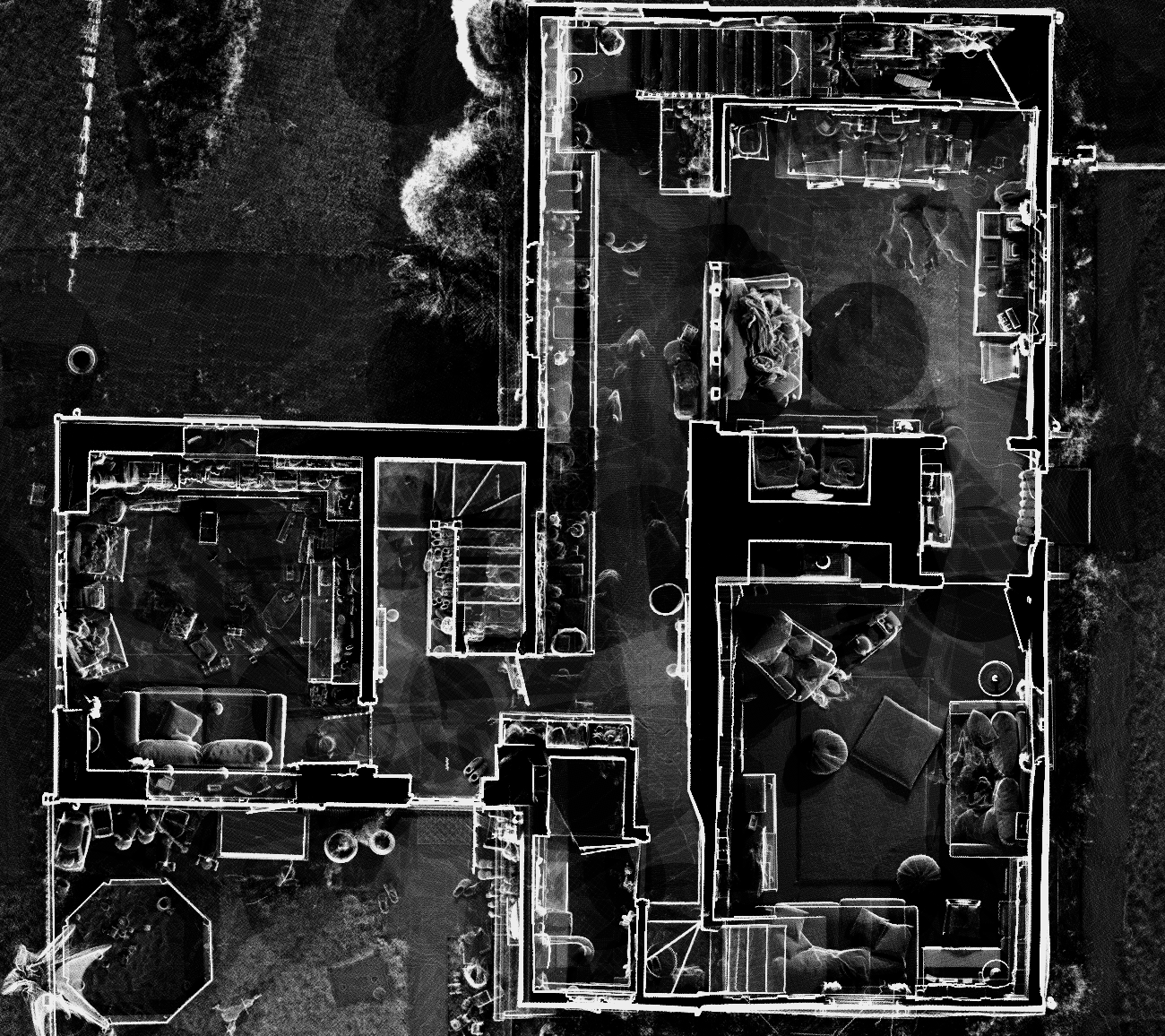
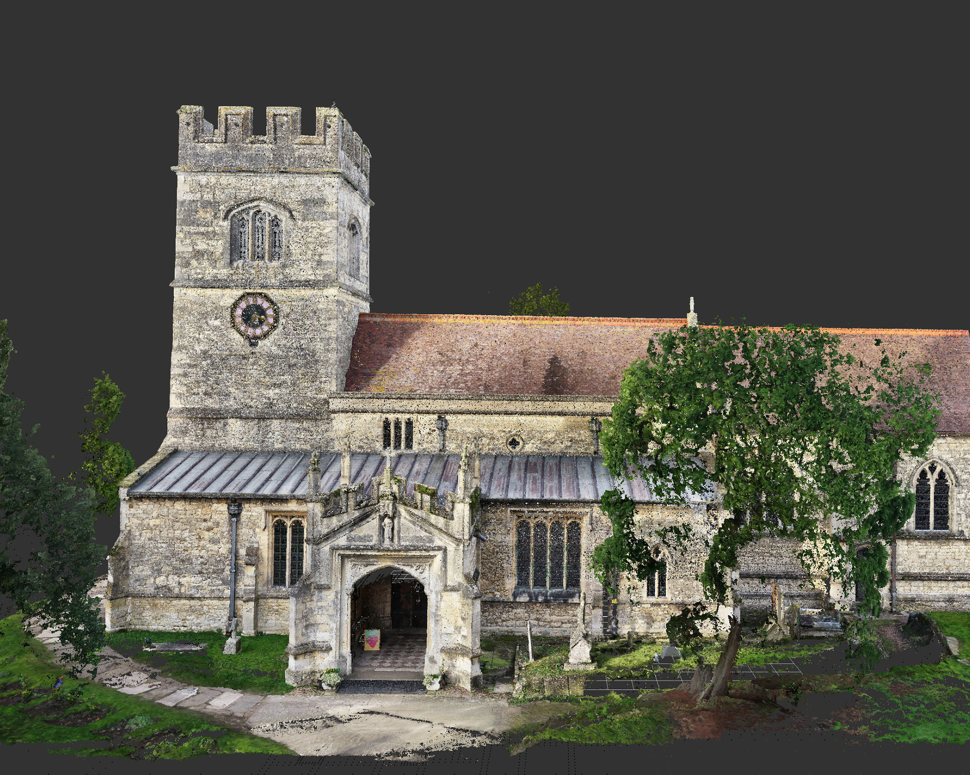
Using advanced total stations, GNSS and laser scanning technology, we capture detailed land, level and feature data suitable for planning applications, architectural design and construction.
Our surveys provide precise ground levels, boundaries and site features — ensuring your drawings reflect the site exactly as it exists.
Our experienced survey team combines modern surveying equipment with robust site control to deliver dependable topographical data across London.
We capture detailed site information including:
Generate precise level data and feature mapping suitable for architects and engineers.
Essential for planning submissions, extensions and new build projects.
Detailed contour plans and digital terrain models (DTM).
Minimal disruption with professional site procedures.
Reduces design errors and unexpected ground issues.
1. Initial Consultation
We review site location, size, objectives and required outputs.
2. Site Control & Data Capture
Survey control established using GNSS and total stations to ensure accuracy.
3. Detailed Feature & Level Survey
We capture all relevant site features, boundaries and levels.
4. Data Processing & CAD Production
Survey data processed into scaled CAD drawings and models.
5. Final Deliverables
You receive accurate, fully annotated drawings ready for design and planning.
We record ground levels, buildings, boundaries, trees, services covers, drainage, kerbs, roads and other site features.
Our surveys are completed to survey-grade accuracy using calibrated professional equipment.
Yes. We supply DWG, PDF and other requested formats.
Yes. Topographical surveys are commonly required for planning and architectural design.
Most residential sites can be surveyed within a day, with drawings typically issued within a few working days.
We provide professional topographical site surveys throughout Greater London and surrounding areas for architects, developers and contractors.
Articles covering measured building surveys, topographical surveys, drone photogrammetry and planning guidance for London property projects.
Existing vs As-Built Surveys – What’s the Difference? Laurel Hardwicke February 20, 2026 For Architects Existing vs As-Built Surveys...
Measured Surveys for Planning Applications – What’s Required? Max Hardwicke February 20, 2026 For Architects Measured Surveys for Planning...
Drone Photogrammetry for Large Residential Sites Laurel Hardwicke February 20, 2026 For Architects Drone Photogrammetry for Large Residential SitesLarge...
We use cookies to improve your experience on our site. By using our site, you consent to cookies.
Manage your cookie preferences below:
Essential cookies enable basic functions and are necessary for the proper function of the website.
These cookies are needed for adding comments on this website.
Statistics cookies collect information anonymously. This information helps us understand how visitors use our website.
Google Analytics is a powerful tool that tracks and analyzes website traffic for informed marketing decisions.
Service URL: policies.google.com (opens in a new window)
You can find more information in our Cookie Policy and .