Existing vs As-Built Surveys – What’s the Difference?
Existing vs As-Built Surveys – What’s the Difference? Laurel Hardwicke February 20, 2026 For Architects Existing vs As-Built Surveys...

128 City Road, London
+44 20 4615 4666
hello@linesurveying.uk
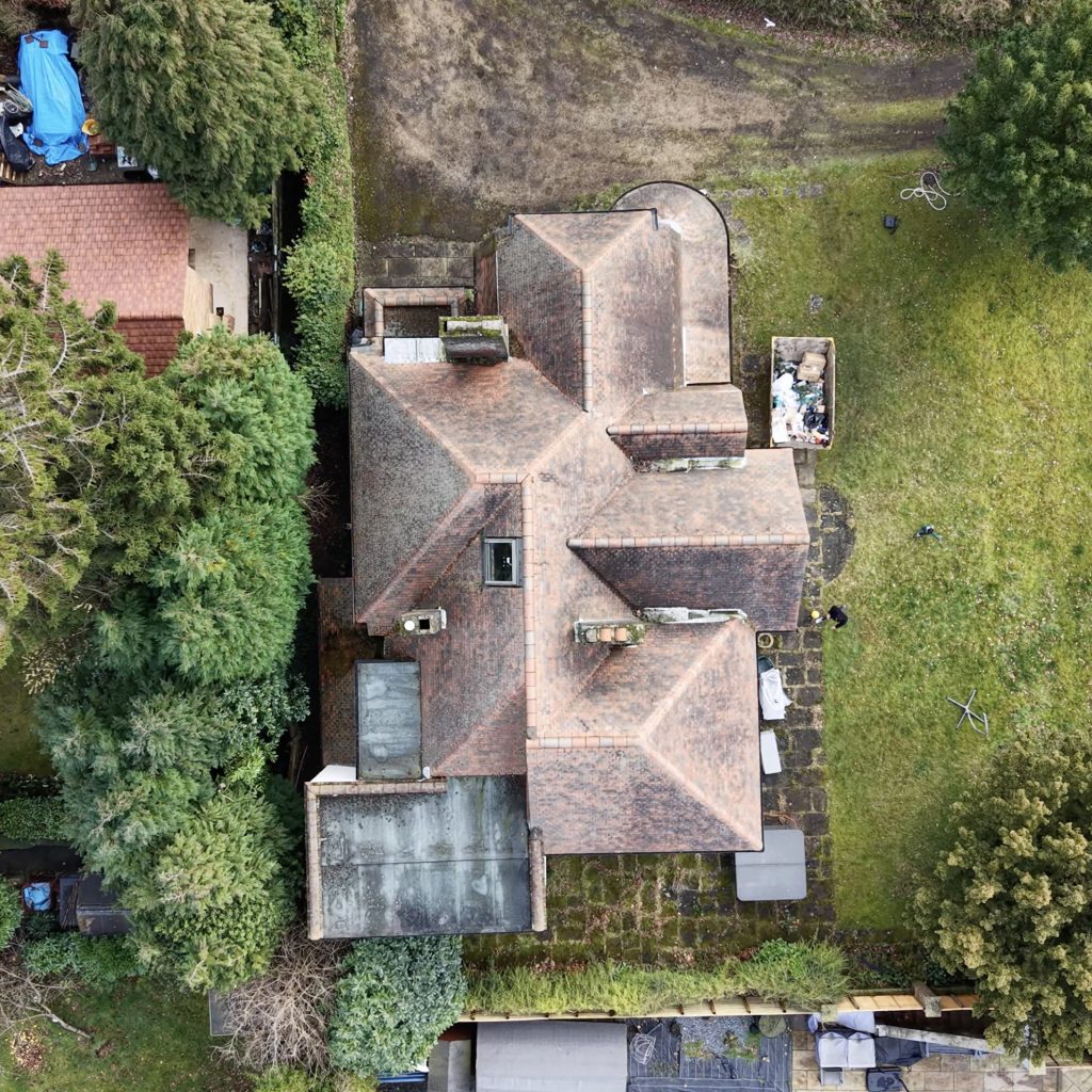
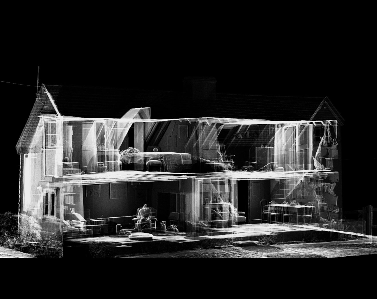
Roof defects are often difficult to identify from ground level. For this reason, we provide high-resolution drone roof inspections across London for residential, commercial and industrial properties.
Using CAA-compliant UAV technology, our team captures detailed aerial imagery of tiles, chimneys, flashings, gutters and other hard-to-reach areas. As a result, inspections can be completed safely without scaffolding or costly access equipment.
Moreover, every survey follows a structured inspection framework. This ensures clear visual documentation, accurate condition assessments and reliable reporting. Consequently, our drone roof inspections are suitable for maintenance planning, insurance claims and pre-purchase evaluations.
Safety and compliance remain central to every project we undertake. Before any flight begins, our certified operators carry out detailed risk assessments and airspace checks.
In addition, we review surrounding structures, access limitations and environmental conditions. By doing so, we ensure full compliance with UK aviation regulations while maintaining the highest professional standards.
Once imagery is captured, it is carefully reviewed and organised into a structured digital report. Therefore, clients receive clear visuals, condition commentary and practical next steps.
Because no physical roof access is required, liability and health-and-safety exposure are greatly reduced.
Most residential inspections are completed within hours rather than days. Therefore, reporting and decision-making can begin much sooner.
By eliminating expensive access equipment and prolonged labour, drone inspections provide a more efficient solution.
Ultra-clear imagery captures tiles, flashings, valleys, chimneys and junctions in precise detail.
High-rise buildings, fragile roofs and restricted locations can be safely assessed without direct contact.
1. Initial Consultation
First, we review your property details, access constraints and inspection objectives.
2. Risk Assessment & Flight Planning
Next, our CAA-compliant operators assess airspace, surrounding hazards and legal requirements.
3. On-Site Drone Inspection
High-resolution imagery is then captured across all relevant roof elevations, including chimneys, gutters and junctions.
4. Structured Reporting
After processing the imagery, we provide a clear digital report with annotated visuals and condition commentary.
5. Recommendations & Next Steps
Where necessary, we outline maintenance priorities or recommend further investigation.
Answers to common questions about how our surveys are carried out, what to expect on site and how the process works.
We conduct a pre-flight risk assessment, review airspace restrictions and confirm safe operating conditions before deployment. Our CAA-compliant drone operators then capture high-resolution imagery of all roof elevations, chimneys, flashings, valleys and gutters. The data is compiled into a structured digital report with clear visual evidence and condition commentary.
No. Drone inspections eliminate the need for scaffolding, ladders or physical roof access in most cases. This significantly reduces cost, risk and disruption to occupants.
Most residential properties are typically inspected within 1–2 hours on site. However, larger or more complex commercial buildings may require additional time depending on size, access and safety considerations.
Yes. All inspections are carried out by fully insured, CAA-compliant drone operators. We complete risk assessments before every flight and operate in accordance with UK Civil Aviation Authority regulations.
You will receive a structured digital report including:
• High-resolution imagery
• Annotated areas of concern
• Roof condition commentary
• Maintenance recommendations (if required)
Reports are suitable for insurance claims, planned maintenance and pre-purchase assessments.
Yes. Drone technology allows us to safely inspect high-rise residential blocks, commercial units, industrial buildings and hard-to-reach structures without physical access equipment.
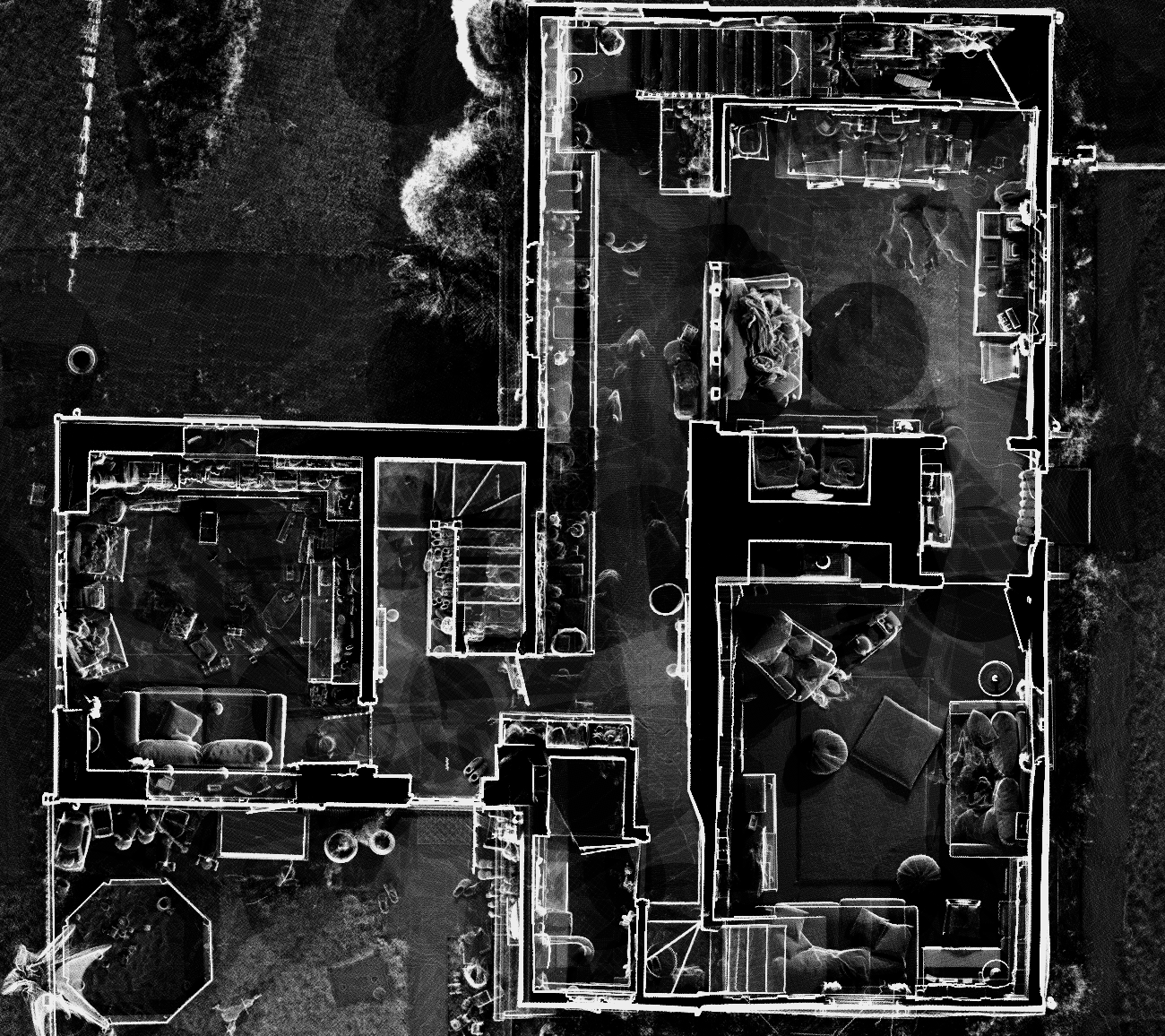
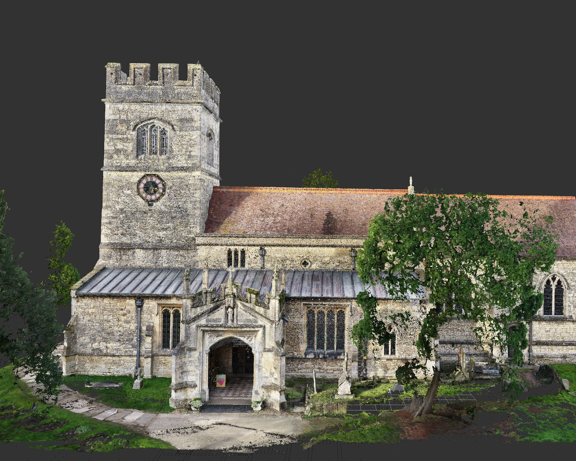
Our London-based survey team delivers high-accuracy 3D laser scanning, point cloud surveys and BIM-ready data capture across London.
Articles covering measured building surveys, topographical surveys, drone photogrammetry and planning guidance for London property projects.
Existing vs As-Built Surveys – What’s the Difference? Laurel Hardwicke February 20, 2026 For Architects Existing vs As-Built Surveys...
Measured Surveys for Planning Applications – What’s Required? Max Hardwicke February 20, 2026 For Architects Measured Surveys for Planning...
Drone Photogrammetry for Large Residential Sites Laurel Hardwicke February 20, 2026 For Architects Drone Photogrammetry for Large Residential SitesLarge...
We use cookies to improve your experience on our site. By using our site, you consent to cookies.
Manage your cookie preferences below:
Essential cookies enable basic functions and are necessary for the proper function of the website.
These cookies are needed for adding comments on this website.
Statistics cookies collect information anonymously. This information helps us understand how visitors use our website.
Google Analytics is a powerful tool that tracks and analyzes website traffic for informed marketing decisions.
Service URL: policies.google.com (opens in a new window)
You can find more information in our Cookie Policy and .